Integrated Urban Transport Planning: 4 Ways Cities Link BRT and Rail
Integrated urban transport planning links Bus Rapid Transit, rail, feeder roads, and non-motorised routes into one network rather than a set of competing services. Cities that get it right co-locate stations, synchronise timetables, unify fares, and place the network under one coordinating authority. The benefits of integrated transport planning show up directly in shorter interchange times and higher ridership across the whole system, not just on the busiest single corridor.
Technical Snapshot: Integration Benchmarks Referenced in This Article
| Metric | Value |
| Lagos Blue Line daily ridership target | ~250,000 passengers |
| Lagos rail-BRT-ferry fare platform | Cowry Card: single account across modes |
| Dar es Salaam DART Phase 1 daily ridership | ~200,000–400,000 passengers |
| Dar es Salaam BRT travel time cut | up to 50% on the trunk corridor |
| Gautrain network scale | ~80 km, 10 stations |
| Johannesburg’s physical rail interchange points | Park, Pretoria, Rhodesfield stations |
| ITDP BRT Standard integration score weight | 15 of 100 total points |
| Hong Kong Octopus card adoption | ~98% of residents aged 15–64 |
Where these benchmarks are applied consistently, cities convert fragmented corridors into networks riders trust enough to abandon private cars for, which is the real test of integrated urban transport planning.
Introduction: Integrated Urban Transport Planning
A Bus Rapid Transit corridor and a commuter rail line can sit two hundred metres apart and still fail the commuter who must walk between them, buy a second ticket, and hope the timetables line up. Closing that gap is what integrated urban transport planning is for. It is not a design flourish added afterward; it is a set of decisions made at the corridor-planning stage about where stations are located, how fares are collected, and which agency has the authority to make buses and trains behave as one system.
BRT delivers rapid transport at a lower capital cost than rail, but it rarely serves an entire metropolitan region on its own. The causes of urban congestion in African cities show why: sprawling low-density growth that no single mode can absorb on its own. Multimodal transport systems in Africa succeed or fail on how well their components connect, not on how impressive any one corridor looks in isolation. This article sets out four mechanisms for that connection, illustrated with transport network integration case studies from Lagos, Johannesburg, and Dar es Salaam.
Principles of Multimodal Integration
Before a city can combine BRT with rail, it needs the rules that enable the two modes to work together. Two principles dominate every functioning network: how physical spaces connect and how payment systems connect. Get these wrong, and no amount of corridor engineering can fix the passenger experience; the cost is not only operational: poorly connected networks push commuters back toward private cars, and the resulting gridlock carries a measurable GDP cost that integration is meant to avoid.
Physical Interchange Design
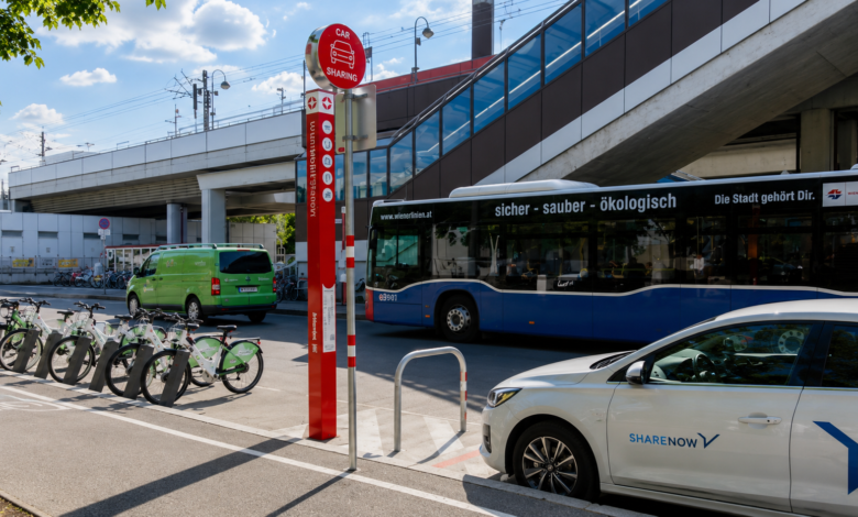
Physical interchange design ensures a commuter can move from a bus platform to a train platform without leaving the building or crossing an unprotected road. Passengers arriving by long-distance modes often carry luggage and need a convenient transfer mechanism built into the station itself. Cape Town’s BRT airport station applies this directly, with buses built to carry luggage so arrivals move onto the network without a mode-specific penalty.
The strongest examples place BRT and rail platforms under one roof, cutting walking distance to under 100 metres. Weaker examples build the two systems on adjacent but separately fenced sites, forcing a street-level detour that adds five to ten minutes to every transfer. That gap in urban transport network design is often the biggest determinant of whether commuters switch modes at all.
Fare and Ticketing Integration
A shared roof means little if a commuter still queues twice and pays twice. Fare and ticketing integration puts all modes on a single account. Lagos illustrates this well: the state’s Cowry Card lets any cardholder switch between buses, trains, and ferries on a single payment platform. Hong Kong’s Octopus card sets the ceiling for what this can achieve, with adoption reaching roughly 98 percent among residents aged 15 to 64 across all modes. For African cities still building smart-card infrastructure, the lesson is sequencing: get one interoperable account working across two modes first, then extend it.
Combining BRT with Rail Networks
BRT and rail solve different parts of the same problem. Rail carries high volumes over long, fixed corridors at speed; BRT covers a denser mesh of routes at a fraction of the capital cost. BRT and rail integration means using each mode where it is strongest and building deliberate points of contact between them, rather than letting the two networks develop in parallel. Nairobi’s planned corridors, drawn from lessons in Colombia’s TransMilenio system, are already being sequenced with this interface logic in mind rather than as a stand-alone bus network.
Further Reading: Nairobi BRT Plan: 5 Proven Lessons from Colombia’s TransMilenio Model
Station Co-Location Strategies
Station co-location is where BRT and rail integration become visible on the ground. Johannesburg offers the clearest African case: The Rea Vaya bus stations at Rissik Street, Harrison Street, and Park Station were positioned specifically to enable easy transfers between the bus and rail systems. Metrorail and Gautrain, in turn, are physically integrated at Pretoria, Rhodesfield, and Johannesburg Park stations, allowing direct passenger transfers even though the two rail systems are owned separately.
Lagos applies the same logic to its own combination of BRT and rail. The Blue Line’s Marina terminus was built as a major interchange where water and road transport modes integrate with the rail line, with pedestrian walkways and overhead bridges linking the rail infrastructure to BRT and non-motorised routes. The BRT financing models that fund these corridors increasingly build interchange infrastructure into the base scope, since retrofitting it later costs far more than designing it in from the outset.
Timetable Synchronisation
Co-located platforms solve the walking-distance problem; timetable synchronisation solves the waiting problem. A rail service every eight minutes paired with a feeder bus every twenty-five minutes still produces long waits, even on adjacent platforms. Dar es Salaam’s DART system shows the value of tight headways: during peak hours, bus intervals on the busiest trunk lines fall to three or five minutes, keeping transfer waits short even without formal coordination with the city’s separate commuter rail service. Where real-time coordination is not yet built, phasing static timetables against each other is a workable interim step.
Integrating Road Networks and Non-Motorised Transport
Rail and BRT trunk corridors only work if commuters can reach them. Most trips begin and end away from a station, on a feeder road or an unmarked footpath. Designing integrated urban transport planning around trunk corridors alone, without the last mile that feeds them, produces high-quality infrastructure that serves only the people who already live beside it.
Feeder Road Design
Feeder roads carry commuters from residential neighbourhoods to the nearest station, and the quality of their design determines how far a station’s catchment extends. Dar es Salaam’s DART network built dedicated feeder infrastructure, with services often run by former dala-dala operators absorbed into the formal system. That shift converted informal minibus operators into feeder partners, a governance change covered further in the political barriers facing BRT governance across the continent. Feeder roads follow the same engineering discipline as any urban road, and cities that skip stages in the road construction lifecycle on feeder routes tend to see them fail years before the trunk corridor they serve.
Pedestrian and Cycling Connectivity
Walking and cycling infrastructure is the cheapest way to expand a station’s catchment, yet it is often the last to be funded. Dar es Salaam’s next BRT phase pairs new bicycle lanes and sidewalk upgrades with its feeder bus corridors, recognising that a rider who cannot safely walk the first kilometre to a station will not use the trunk system. Effective design follows three rules: continuous footpaths free of parked vehicles, separated cycling lanes, and lighting adequate for early and late commutes. Where these are missing, station catchments shrink, undermining the case for combining public transport modes at all.
Institutional Coordination for Integration
None of the physical or fare integration above would survive without an institution capable of compelling separate operators to cooperate. Multimodal transport systems in Africa are usually built by different agencies on different funding timelines, making institutional coordination the least visible yet most decisive layer in the design of integrated public transport systems. Weak coordination is also one of the underlying barriers that keep commuters reliant on private vehicles rather than shifting them onto a network they cannot yet trust to connect them.
Further Reading: Public Transport vs Private Vehicles: 4 Barriers to Shifting Mobility
Single Transport Authority Models
The clearest model is a single authority with planning power across every mode. Lagos built this through the Lagos Metropolitan Area Transport Authority, which is responsible for the state’s train services, BRT regulation, and non-motorised transport policy under one roof, giving it the authority to insist that a new rail line and an existing BRT corridor share a station. Johannesburg’s experience is more layered: Gautrain is managed by a provincial agency and operated by a private concessionaire, while Rea Vaya sits under city-level control, with province and city coordinating rather than merging outright.
Data Sharing Between Operators
A single authority still needs the operational data to act on. Effective transfers depend on scheduled services communicated through both static timetables and dynamic real-time vehicle information. Without a shared data layer, an operator cannot hold a connecting bus for a delayed train. Jakarta’s JakLingko platform is the clearest global reference for this stage: it connects BRT, MRT, LRT, commuter rail, and feeder buses under one unified fare and payment ecosystem designed to minimise transfer times. Dar es Salaam’s DART agency has studied Jakarta and Dakar directly to plan for real-time information and a revamped smart-card system, a practical answer to the question of how cities integrate BRT rail and road networks into a single operating picture.
Integration Standards and Benchmarks for African Transit Networks
Turning these four mechanisms into a design brief requires numbers, not just principles. This section sets out the interchange time standards used to assess integration quality, compares how three African networks perform against these standards, and concludes with the case for a single-network mindset.
Interchange Time Standards
The ITDP BRT Standard, the reference framework for evaluating BRT corridors worldwide, treats multi-modal integration as a scored category rather than an afterthought. It awards 15 of its total points to access and integration, covering connections with other public transport, cycling, and walking, with the goal of maximising transfer possibilities while minimising idle and wait times. That weighting is a useful design target: a corridor that treats integration as roughly 15 percent of total design quality aligns with what independent auditors actually measure.
Interchange Time Standards: Design Targets for BRT-Rail Transfers
| Interchange Element | Design Target |
| Walking distance, co-located BRT-rail platforms | Under 100 metres, weather-protected |
| Peak-hour feeder bus headway | 3–5 minutes on trunk-adjacent routes |
| Fare transaction time per transfer | Single tap, one account across modes |
| Wayfinding signage | Time-based distances, consistent across operators |
Case Comparisons of Integrated Networks
Placing Lagos, Johannesburg, and Dar es Salaam side by side shows three starting points converging on the same design logic.
Case Comparison: BRT-Rail Integration Across Three African Cities
| City | Physical Co-Location | Fare Integration | Institutional Model |
| Lagos | The marina terminus links rail, road, and ferry | Cowry Card across bus, rail, ferry | Single authority, LAMATA |
| Johannesburg | Park, Pretoria, Rhodesfield stations | Separate ticketing, physical transfer only | Multi-agency coordination |
| Dar es Salaam | Terminals and feeder stations built into the DART scope | Prepaid cards not yet deployed system-wide | Single authority, DART |
Lagos leads in fare integration because its rail and BRT were planned under a single authority from the outset. Johannesburg leads on physical co-location because three separate operators recognised the commercial case for sharing a precinct without merging institutionally. Dar es Salaam is furthest ahead on feeder infrastructure, but is still finalising the smart-card layer needed for multimodal urban mobility systems in Africa to reach Lagos-level fare integration.
Conclusion: The Case for a Single Network Mindset
The evidence across Lagos, Johannesburg, and Dar es Salaam points to one conclusion: transport modes planned and built in isolation still function in isolation, however well engineered each one is individually. Integrated urban transport planning is what converts a rail line and a BRT corridor from two separate projects into a single network that a commuter can navigate on a single ticket, through a single interchange, on a connecting schedule.
The cities making the fastest progress share a pattern: they gave one authority, or one tightly coordinated group of authorities, the mandate to design stations, fares, and schedules across modes from the start, rather than retrofitting integration after each system was already operating on its own terms. As African cities commit further capital to public transport expansion, returns will depend less on how impressive any single corridor looks and more on how convincingly the whole integrated urban transport planning effort functions as a single system.
Build Better Cities Through Integrated Transport
Explore more technical transport infrastructure analyses, urban mobility reviews, and transit planning deep dives on Construction Frontier: Urban Infrastructure & Transportation Planning, where multimodal transport systems, BRT and rail integration, sustainable mobility, and proven urban transport strategies are examined through practical civil engineering insight.